EXPLORE South Africa’s Barberton Makhonjwa Mountains with this slideshow, check the location map and get all the facts and information below.
For slideshow description see right or scroll down (mobile). Click to view slideshow

Location and Values: The Barberton Makhonjwa Mountains are located in South Africa’s north-eastern province of Mpumulanga, adjacent to the Swaziland border. The world heritage site includes five small nature reserves (including the whole of the Songimvelo and Nkomazi Wilderness Nature Reserves) while a third of the site lies outside formally protected areas on private land used for timber production and agriculture/tourism. The Barberton Makhonjwa Mountains area is of exceptional interest geologically, because of its very ancient rocks. The designated site represents the best-preserved, thick and diverse succession of volcanic and sedimentary rocks from the period when the first continents were starting to form, 3.6 to 3.25 billion years ago. It provides evidence of the natural setting in which the Earth’s first cellular life began to appear.
Slideshow description

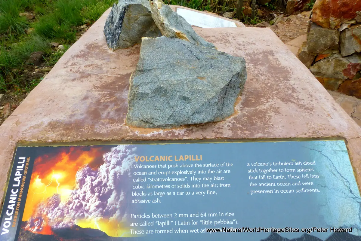
The slideshow ‘tells the story’ of South Africa’s Barberton Makhonjwa Mountains with a portfolio of photos by Peter Howard from a visit in November 2014. It features the excellent 37 km Barberton Makhonjwa Geotrail, which has been established for the enjoyment and education of those who may have missed out on a degree in geology (and might otherwise fail to appreciate the importance of the place). The Geotrail follows the main road between the town of Barberton and the Swaziland border, providing educational displays at lookouts, scenic spots and road cuttings where interesting rock strata have been exposed. There are 11 roadside stops along the trail, with some far-reaching views across the landscape and some of the key geomorphological features, such as the Dycedale Syncline, explained with roadside displays. Many of the lay-bys are provided with picnic tables and rest facilities alongside the geological displays. Starting from the Barberton end of the Geotrail, 11 types of rock are highlighted, starting with the youngest types at the Barberton end (where rocks of around 3.2 billion years are found) and ending at the higher elevations close to the Swaziland border where older rocks (up to 3.6 billion years old) predominate. This ‘journey through time’ features the following types of rocks in their natural setting, (most of which are shown in the slideshow) from youngest to oldest: alluvial conglomerate; tidal sandstone; biomats; barite; tsunami conglomerate; banded chert; banded ironstone; volcanic lapilli; black chert; pillow lavas and greenstone.
Factfile
Website Category: Earth Features
Area: 1,131 km2
Inscribed: 2018
Criteria:
- Geological features (viii);