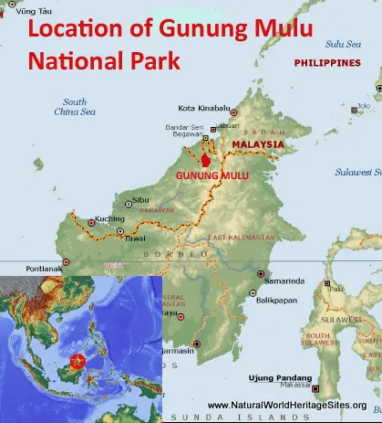
EXPLORE Malaysia’s Gunung Mulu National Park with this slideshow, check the location map and get all the facts and information below.
For slideshow description see right or scroll down (mobile). Click to view slideshow
Location and Values: The Gunung Mulu National Park is located on the island of Borneo in the Malaysian state of Sarawak, close to the border with Brunei. It includes an extensive limestone karst area with some of the world’s largest cave chambers and longest tropical cave systems, in a tropical rainforest area with exceptional biodiversity. It is listed as a world heritage site under all four natural criteria, reflecting the natural beauty of the rainforest environment and cave formation (speleothems); the importance of the surface and underground geomorphology in the understanding of uplift and tectonic processes in this part of Asia; the ecological processes involved in the origins and evolution of troglobitic cave fauna; and the exceptional biodiversity represented in this relatively small area of tropical forest with its underlying geological complexity and range of elevation from close to sea level to the summit of Gunung Mulu at 2,377m.
Conservation Status and Prospects. According to IUCN’s Conservation Outlook Assessment (2017) the conservation status of the Gunung Mulu National Park is ‘good’. The IUCN report notes that ‘The conservation outlook for Gunung Mulu National Park is overall very positive. The combination of the remoteness (no public road access), rugged terrain, legislative basis of protection, existence and implementation of an Integrated Development and Management Plan, 5 year plan, very effective professional management and dependence of a valuable tourism industry on the park augers well for all contribute to on-going effective protection and management. Notwithstanding, there are a number of potential threats external to the park that need to be monitored and kept under review including possible changes in government position on the proposed Tutoh Hydro Dam, logging and palm oil plantations in adjacent forests, oil and gas development and associated road access and demand for increased/inappropriate cave infrastructure for tourism. ’
Links:
Google Earth
Official UNESCO Site Details
IUCN Conservation Outlook
UNEP-WCMC Site Description
Birdlife IBA
Slideshow description
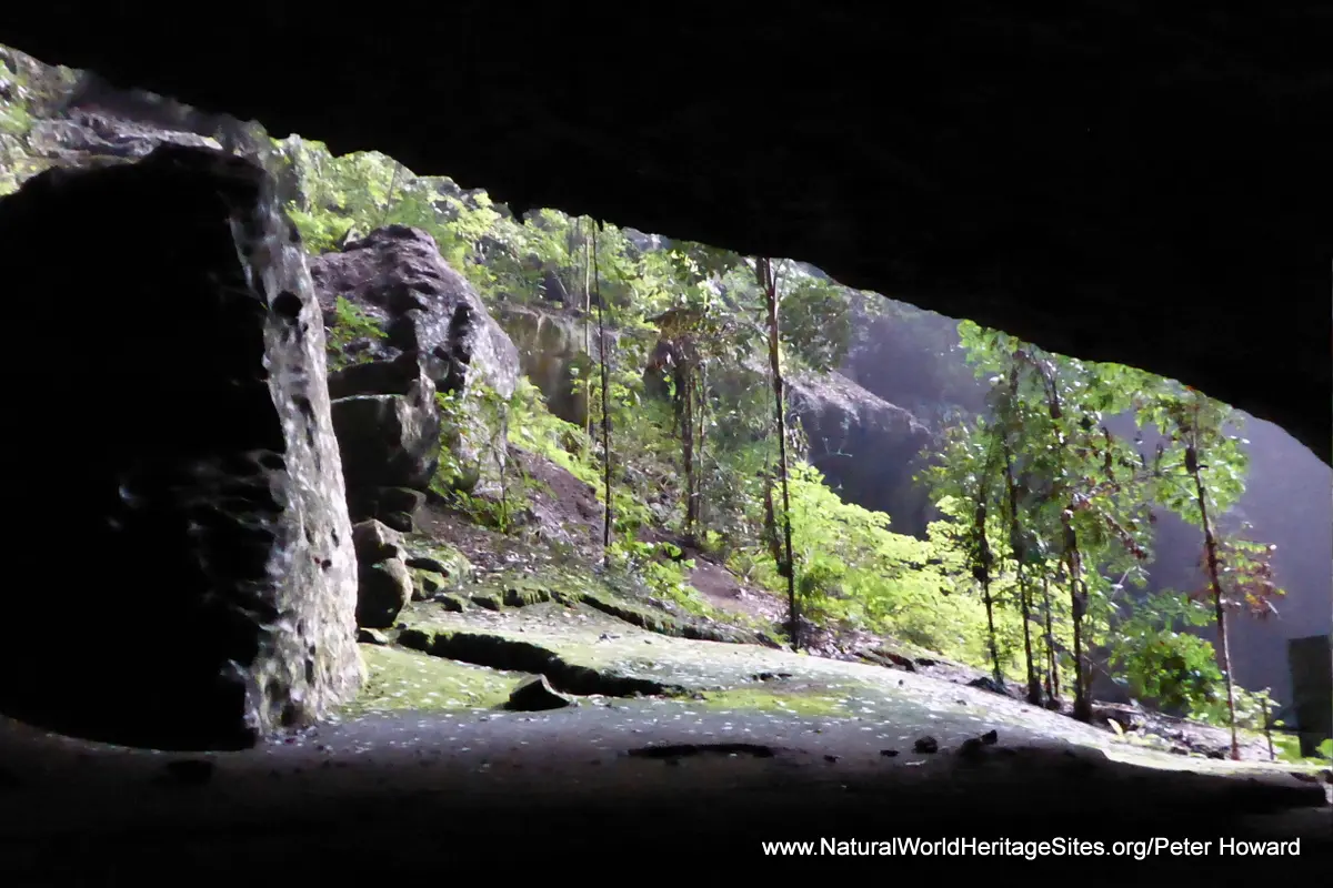
The slideshow ‘tells the story’ of Malaysia’s Gunung Mulu National Park with a portfolio of photos by Peter Howard from a visit in December 2017. It shows some of the main features of the ‘tourism zone’ of the park, recognizing that this is a remote area only accessible by air, which has no roads and where 90% of the park and 95% of its caves are closed to visitors. Despite the logistical challenges, the management authorities have done an exceptionally good job of providing visitor access and a diverse range of activities for visitors, including access to four spectacular ‘show caves’. The slideshow begins with views of the cloud-covered mountain back-drop as the plane descends, and the suspension foot-bridge that spans the river at the park boundary and provides access to its interior. One of the most popular activities at the park is to watch the exodus of free-tailed bats from Deer Cave at dusk, where up to 3 million individual bats roost, making it one of the largest colonies in the world.
Most park activities are guided, and it is necessary to book and pay at the visitor centre in advance. There is one long (3 km) board walk through the forest, with trails leading off it and some informative educational displays. The boardwalk provides access to a canopy walkway where limited numbers of visitors can view the rainforest plants and animals at close quarters from an elevated position in the canopy. And there are a few self-guided trails leading off the board walk where visitors can search for interesting plants and animals or simply enjoy the grandeur of the rainforest trees and a few small waterfalls in their own time.
Gunung Mulu National Park is most recognized internationally for its massive tropical caves and four of them are open to guided groups of about 20 visitors at a time. The slideshow illustrates some features of a visit to Deer Cave which is reckoned to have the largest cave passage in the world with a diameter of 120-150m. Within the cave are various small animals (other than bats) that are specially adapted to life underground, and in deeper sections of the cave systems where permanent darkness prevails, animals are inclined to evolve towards the loss of all pigment and sight, becoming white and blind. After the cave photos, further images show a guided night walk, during which visitors are likely to see creatures that would elude them during the daytime – extraordinary stick insects, a diversity of frogs and lizards. The diversity of rainforest plants is extraordinary, especially amongst the ferns, palms and orchids, and some particularly intriguing species can be found – such as the insectivorous pitcher plant (which traps insects as a source of nutrients by drowning them).
Another activity offered to visitors at Gunung Mulu National Park is a trip to the Clearwater Cave (which may still to hold the title of longest cave in Asia, with 110 km of mapped passages). This excursion starts with a trip through the rainforest in a motorized canoe, stopping at a local village on the park boundary, and including a visit to Wind Cave (a side-passage of Clearwater cave). The main chamber of Clearwater cave has been made accessible with steel ladders, steps and concrete walkways, as well as some electric lighting, so visitors can get an idea of some of the typical features of a tropical river cave without too much adventure and risk!.
Factfile
Website Category: Caves & Karst
Area: 529 km2
Inscribed: 2000
Criteria:
- Exceptional natural phenomenon (vii);
- Outstanding natural beauty (vii);
- Geological features (viii);
- Ecological processes (ix);
- Natural habitat for biodiversity (x);
- Significant number of rare, endemic and/or endangered species (x)


