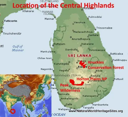
EXPLORE THE CENTRAL HIGHLANDS OF SRI LANKA with this slideshow, check the location map and get all the facts and information below.
For slideshow description see right or scroll down (mobile). Click to view slideshow
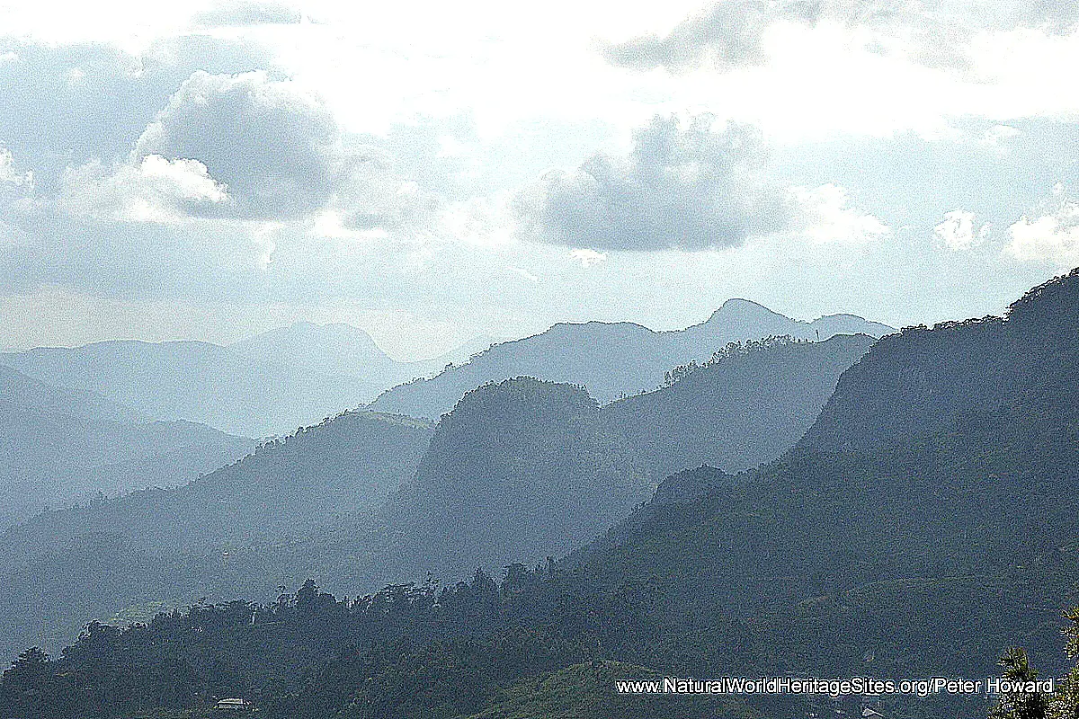
Location and Values: The Central Highlands of Sri Lanka occupy land at higher elevations in the south-central part of the island, up to about 2,500m. The world heritage site comprises two geographically-separated components with the Knuckles Conservation Forest lying to the north and the Peak Wilderness/Horton Plains complex further south. These two areas protect much of the last remaining montane forest in Sri Lanka (where most of the surrounding land has been converted to tea plantations). Biogeographically the area shows close affinities with India’s Western Ghats, the range of mountains that follows the sub-continent’s western flank. Together with the Western Ghats, the Central Highlands of Sri Lanka is regarded as one of the eight ‘hottest hotspots’ for biodiversity in the world, with exceptionally high levels of species richness and endemism. The Sri Lankan part of the hotspot exhibits particular attributes related to its biological isolation as an island environment, enabling the evolution of especially high numbers of endemic species, including many that are restricted to montane areas of the island. There are 408 species of vertebrates known from the world heritage area, of which 141 (34%) are endemic to Sri Lanka, including many reptiles and amphibians, as well as 13 of Sri Lanka’s endemic birds. Evolutionary pressures have resulted in distinct forms of an endemic monkey (purple-faced langur), and a unique sub-species of leopard.
Conservation Status and Prospects. According to IUCN’s Conservation Outlook Assessment (2017) the conservation status of the Central Highlands of Sri Lanka is ‘good, with some concerns’. The IUCN report notes that ‘ The values of the site remain intact due to relatively low levels of threat coupled with sound protection and a largely effective management regime. The recent completion of a more effective management planning framework for the site is welcome. However, the maintenance of the values is dependent on the continued efforts to address issues of concern and put in place the necessary staffing and funding to guarantee implementation of planned actions. Tourism impacts, invasive species and indirect impacts from the buffer zones appear to be the most significant current threats to the site. The management authorities will need to continually monitor the condition of values and adapt management accordingly to ensure the conservation outlook for this property remains positive.’
Links:
Google earth
Official UNESCO Site Details
IUCN Conservation Outlook
UNEP-WCMC Site Description
Birdlife IBA
Slideshow description
The slideshow is intended to ‘tell the story’ of the Central Highlands of Sri Lanka, and features a portfolio of photos from a visit by Peter Howard in October 2017. Each of the three main areas of this serial site were visited starting with the Knuckles Conservation Forest (313 km2) and proceeding to Horton Plains National Park (31 km2) and the adjoining Peak Wilderness Nature Reserve (206 km2). The easiest access to Knuckles Conservation Forest is via the B274 road between Matale and Pallegama, as this passes through various forest and vegetation types and allows far-reaching views across the high grasslands and mountain peaks. A short hike can be made to Riverston peak and the drive allows visitors to view some of the area’s unique biodiversity (recognizing that most endemic species are small and may not appear especially distinctive – grasshoppers, ferns and lichens amongst them).
The second part of the slideshow covers the small Horton Plains National Park (which was shrouded in low-lying cloud at the time of my visit). Here there is a small interpretation centre with some useful explanation of the area’s global significance as a biodiversity hotspot and photos of some of the rare endemic species (that are unlikely to be seen during a casual visit) such as the Horton Plains slender loris (a nocturnal primate) and yellow-striped chevrotain (a mouse deer). The park offers the opportunity for a number of self-guided hikes through the upland grasslands and montane forests with the benefit of some excellent interpretative displays (on subjects such invasive species and the influence of fire) along the way. The most popular circular route takes in ‘World’s View’ and Bakers Falls. Some impressive cloud forest, with stands of giant tree ferns and trees draped in moss and lichens is experienced and visitors are likely to see sambar deer on the grassy plains near the summit.
The final part of the slideshow covers the Peak Wilderness area, including a hike to the summit of Adam’s Peak, a holy pilgrim site. The hike provides far-reaching views of the surrounding forest and close encounters with some of the area’s wildlife – endemic birds, moths, and endemic toque macaques with their apparently crazy hairstyles! The conservation areas are surrounded by intensive tea plantations, and some of the original indigenous forest has been replaced with Eucalyptus and conifer plantations (which now serves as a ‘buffer zone’ to the world heritage area). The last part of the slideshow shows some of the best remaining indigenous forest along the (B339) road that traverses the Peak Wilderness between Campion tea estate and Balangoda. Here visitors may be fortunate to see the endangered endemic purple-faced langur monkey or (much less likely!) one of Sri Lanka’s endemic sub-species of leopard (a zoo animal shown here).
Factfile
Website Category: Tropical & Sub-tropical Forests;
Area: 568 km2
Inscribed: 2010
Criteria:
- Ecological processes (ix);
- Natural habitat for biodiversity (x);
- Significant number of rare, endemic and/or endangered species (x)


