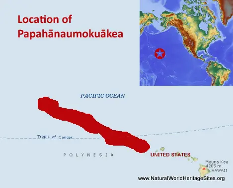
EXPLORE Papahānaumokuākea with this slideshow, check the location map and get all the facts and information below.
For slideshow description see right or scroll down (mobile). Click to view slideshow
Location and Values: Papahānaumokuākea is one of the largest marine protected areas in the world, covering a vast area in the north-central Pacific Ocean, including a linear cluster of islands, atolls, cays and pinnacles that lie to the northwest of the main Hawaiian archipelago. It covers an area similar in size to the US State of Montana, slightly larger than Australia’s Great Barrier Reef and bigger than Italy. It is a mixed cultural and natural site that embodies the concept of kinship between people and the natural world, includes archaeological remains from the pre-European era, and embraces the living traditions of native Hawaiians who maintain shrines on some of the islands associated with the sacred realms of life and death.
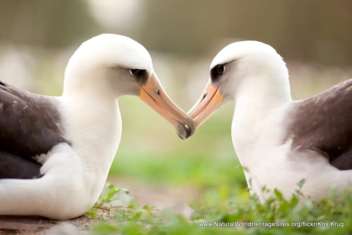
Geologically it covers a major portion of the world’s oldest and longest volcanic chain that has shaped our understanding of plate tectonics and island hotspot progression. Biologically it encompasses a multitude of habitats including parts of the deep ocean, seamounts and submerged banks, coral reefs, cliffs, sandy beaches, dunes, grasslands, shrublands and a hypersaline lake. A quarter of the known 7,000 marine species are endemic, including the critically endangered Hawaiian monk seal, four species of birds and six endangered plants. The islands of Papahānaumokuākea support 5.5 million nesting seabirds, making it the largest tropical seabird rookery in the world, with most of the world’s Laysan Albatross (classified as ‘vulnerable’ to extinction) and Black-footed albatross (endangered).
Conservation Status and Prospects. According to IUCN’s Conservation Outlook Assessment (2020) the conservation status of Papahānaumokuākea is ‘good, with some concerns’. The area has been subject to a variety of human impacts over the past 200 years including military activities, collection of seabird eggs and feathers, whaling, fishing and guano mining. This has impacted the low-lying islands particularly, especially Midway Atoll (where there is still a military base and airfield) and Laysan Island (impacted by guano mining, now mostly restored). There are still five principal threats to the site arising beyond its boundaries, namely the grounding of ships, illegal fishing, marine litter, invasive alien species and climate change.
As far as alien species are concerned, these affect marine and terrestrial environments. The impacts on the marine environment have so far been minimal, but the ecology of the low-lying islands has been badly affected by the introduction of rats, mice, rabbits and as many as 249 species of terrestrial invasive plants (on Midway Atoll). Rats and rabbits have now been successfully eradicated but programmes for the eradication of other invasive species are still ongoing.
Some impacts of climate change have already been observed, such as coral bleaching events, but the full extent of possible future impacts remains to be understood. Climate change is expected to cause sea levels to rise so low-lying areas are likely to be inundated, while increased storm activity will increase seawater intrusion into terrestrial habitats. The rise in sea surface temperatures that is already causing a certain amount of coral bleaching may have more profound knock-on effects on marine productivity and affect the success of sea-bird foraging. Similarly, seawater acidification is likely to impact deep water habitats and the deep reefs where monk seals (and other species) forage.
Links:
Google Earth
Official UNESCO Site Details
IUCN Conservation Outlook
UNEP-WCMC Site Description
Birdlife IBA
Slideshow description
The slideshow ‘tells the story’ of Papahānaumokuākea with a portfolio of photos that illustrate the marine and terrestrial features of this outstanding place, including some of the typical marine life, birds, terrestrial environments and animals.
Most of the photos are provided by the Papahānaumokuākea Marine National Monument, USFWS Headquarters, USFWS Pacific Region, NOAA Photo Library and National Marine Sanctuaries. In addition the following Flickr photographers are acknowledged with thanks for their contributions: Kris Krug, Brian Omura, flikker-photos, Jen-R., Kanaka Rastamon and vivtony00.
Factfile
Website Category:
Marine & Coastal
Area: 362,075 km2
Inscribed: 2010
Criteria:
- Geological features (viii);
- Ecological processes (ix);
- Significant number of rare, endemic and/or endangered species (x)
- Cultural criteria (iii, vi)


