EXPLORE Paraty and Ilha Grande – Culture and Biodiversity with this slideshow, check the location map and get all the facts and information below.
For slideshow description see right or scroll down (mobile). Click to view slideshow

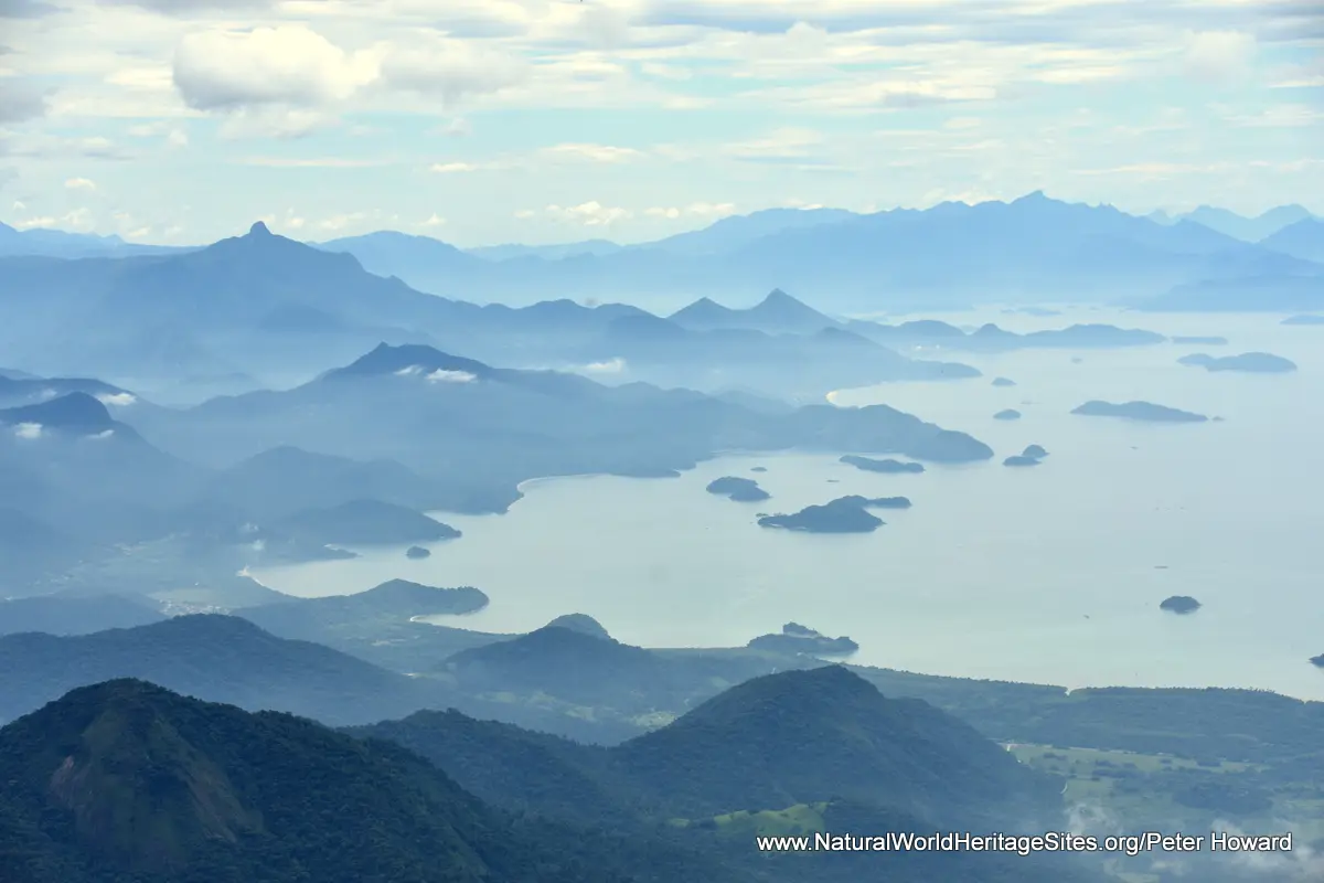
Location and Values: The Paraty and Ilha Grande World Heritage Site is located along the Atlantic seaboard of South America, mid-way between Sao Paulo and Rio de Janeiro in southern Brazil. It is designated as a cultural landscape, recognizing the importance of Paraty as one of Brazil’s best-preserved historic towns, and its association with the biologically diverse forests that surround it. From a biodiversity viewpoint, Brazil’s Atlantic Forest is considered to be one of the world’s key biodiversity hotspots as well as being one of its most threatened habitats, with only about 7.3% of the original forest remaining. The site includes most of the forested slopes of a massive ‘amphitheatre’ of hills overlooking a bay, dotted with islands, including the largest, Ilha Grande. It includes four designated protected areas, covering a wide range of elevation (from sea level to around 2,000m) and corresponding diversity of habitats, with evergreen rainforests, high-altitude grasslands, mangrove communities and coastal sandbanks.
Conservation Status and Prospects. According to IUCN’s 2019 evaluation of the nomination the protection status of the site is satisfactory. Nevertheless, the evaluation document identifies a number of ongoing and potential threats to its long-term conservation, and recognizes, in particular, that some of the protected areas have resident populations whose livelihoods depend on the exploitation of natural resources. Ranching is a significant threat because it involves forest clearance, and may impact watershed protection as well as leading to the extermination of predators such as jaguars and cougars (which are essential elements in maintaining the ecological integrity of the site). Other potential threats that require monitoring and mitigation include (1) fishing, (2) climate change, and (3) tourism development. In addition there is a potential threat from a chytrid fungus which is devastating frog populations in other areas and could easily spread here, leading to the extinction of species endemic to this site. Two further potential threats arise from the proximity of major industrial facilities, namely the Almirante Alvaro Alberto Nuclear Centre and the Petrobas Port Terminal. These two facilities have the potential to cause serious pollution, and may lead to the accidental introduction of invasive marine species by ships around the port and shipping lanes.
Links:
Google Earth
Official UNESCO Site Details
Birdlife IBA
Slideshow description

The slideshow ‘tells the story’ of the Paraty and Ilha Grande World Heritage Site with a portfolio of photos by Peter Howard from a visit in January 2020. They illustrate the historic centre of Paraty, with its well-preserved colonial architecture, as well as the landscape features of the surrounding protected areas. The slideshow begins with some general views of the ‘amphitheatre’ of forest surrounding the bay, followed by a series of photos showing the colonial architecture in the historic centre of Paraty and the archaeological remains of the Defensor Perpetuo Fort overlooking the town from the Morro da Vila Velha.
The second part of the slideshow illustrates some of the coastal and lowland forest areas in the southwest of the site, including parts of the Cairucu Environmental Protection Area and adjoining areas in the extreme south of Bocaina National Park. This area includes some stunning sandy bays, with crystal clear waters and (near the coastal resort of Trinidade) a delightful natural swimming pool, punctuated with massive granite boulders. The lower reaches of the rivers and streams running through the forested hills around here are dotted with spectacular waterfalls and cascades.
The final part of the slideshow features the magnificent views and diverse flora of the higher-lying areas of Bocaina National Park, around the summit at the Mirantes da Pedra da Macela. Visitor facilities in the interior of the protected areas are still rather rudimentary and this is one of the few access points. Some of the typical plants are shown, including various species of bromeliad, ferns, fuschia and begonia. The last few slides illustrate a couple of issues that continue to threaten this site and other areas of Brazilian Atlantic Forest, namely (1) land clearance for cattle ranching and (2) wildlife killed by road traffic.
Factfile
Website Category: Tropical & Sub-tropical Forests
Area: 1,731 km2
Inscribed: 2019
Criteria:
- Natural habitat for biodiversity (x);
- Significant number of rare, endemic and/or endangered species (x);
- Cultural criterion (v)