EXPLORE Plitvice Lakes National Park with this slideshow, check the location map and get all the facts and information below.
For slideshow description see right or scroll down (mobile). Click to view slideshow
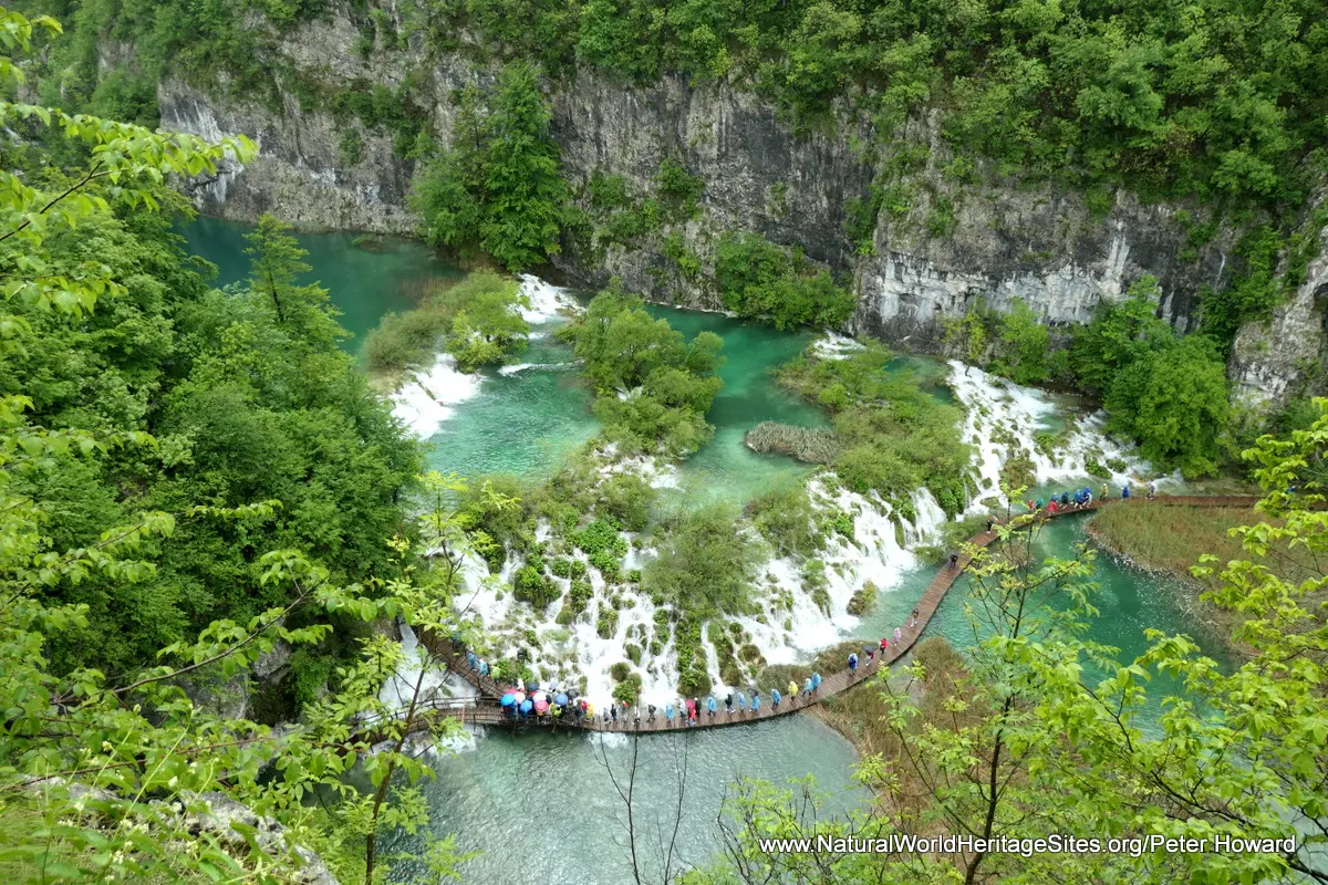
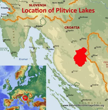
Location and Values: Plitvice Lakes National Park is located in the limestone hills that rise above the Adriatic Sea, about 60km east of Croatia’s coastal town of Zadar. The lakes themselves are exquisitely beautiful – a series of sixteen turquoise gems, punctuated by spectacular cascades as the water tumbles over a series of travertine terraces that cross the steep-sided valley between each lake. The travertine barriers are created by the deposition of calcium carbonate from the mineral-rich waters in a complex biodynamic process that only occurs at a similar scale in a few other places around the world (including several other world heritage sites, such as China’s Huanglong and Jiuzhaigou Valleys). The lakes occupy a relatively small area within the park (where tourism activities are concentrated), but the park hinterland is extensive and supports a diversity of fauna and flora in its forest and grassland habitats. Most importantly, protection of the upstream hinterland ensures that the complex biodynamic processes, water quality and other environmental conditions required for the ongoing processes of travertine formation are protected.
Conservation Status and Prospects. According to IUCN’s Conservation Outlook Assessment (2017) the conservation status of the Plitvice Lakes National Park is of ‘significant concern’. The IUCN report notes a number of threats to the site, particularly problems over water quality and a trend of rapid eutrophication (nutrient enrichment) which could upset the delicate biodynamic processes involved in travertine formation. The report also notes concerns over the rapid expansion of tourism facilities within (and around) the property which may also affect the site’s sensitive hydro-geological system, and the visual integrity of the site.
Links:
Google Earth
UNESCO Official Website
IUCN Conservation Outlook
UNEP-WCMC Site Description
Birdlife IBA
Slideshow description
The slideshow ‘tells the story’ of Plitvice Lakes National Park with a portfolio of photos by Peter Howard from a visit in May 2019. They illustrate the diversity of waterfalls, lakes, and other landscape features in Plitvice’s wooded valleys, as well as some of the typical plants and animals. The park authorities have established a series of carefully managed walking trails, with boardwalks and paved sections, linked across the lakes by electrically-powered boats and by bus using out-of-sight service roads running through the woodlands above the lakes. These free-to-use services enable the park to host large numbers of visitors without allowing private vehicles into the park. The slideshow starts with photos of the boat service across the eastern end of Kozjak Lake (near entrance 2) and follows the park’s walking trail ‘E’ along the shores of the ‘upper’ lakes, crossing between them via the travertine terraces. From the furthest point of this trail, visitors are able to use the bus service to return to the entrance or reach the start of other trails. The slideshow continues with photos from the ‘lower’ section of the lakes complex (accessed via entrance 1), on the following (rainy) day. This is the most intensively visited part of the park, (following walking trail ‘A’) with highlights that include The Big Waterfall; the boardwalk that crosses the water close to the cascades tumbling over the travertine terrace between Lakes Gavanovac and Kaluderovac; the entrance to one of the park’s many caves (closed at the time of this visit); and the cliff-top views of the travertine terraces and string of lakes that fill the valley. The slideshow finishes with views of The Big Waterfall from the opposite side of the valley (near entrance 1).
Factfile
Website Categories: Caves & Karst;
Area: 296 km2
Inscribed: 1979 (Extended 2000)
Criteria:
- Outstanding natural beauty (vii);
- Geological features (viii);
- Ecological processes (ix);


