EXPLORE Purnululu National Park with this slideshow, check the location map and get all the facts and information below.
For slideshow description see right or scroll down (mobile). Click to view slideshow

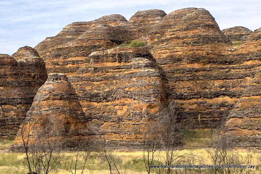
Location and Values: Purnululu National Park is located in the north of Australia, along the border between Western Australia and the Northern Territory. Its main outstanding feature is a range of extraordinary cone-shaped sandstone hills, known as the Bungle Bungle Range. The underlying strata are weathered and encrusted with cyanobacteria in a way that creates a spectacular orange and black banded appearance. The pastel colours of the landscape change as they are affected by rain and the path of the sun, while sheer-sided gorges, seasonal waterfalls, pools and isolated stands of majestic Livistona fan palms lie hidden within the maze of rock towers.
Conservation Status and Prospects. According to IUCN’s Conservation Outlook Assessment (2020) the conservation status of the Purnululu National Park is ‘good’. The IUCN report notes that the underlying geomorphology that justifies its world heritage status is robust and likely to withstand any potential environmental changes. Purnululu National Park is well managed, although its biodiversity values are to some extent threatened by climate change, the spread of alien species of plants and animals (cane toads are a particular present problem), and the periodic incidence of catastrophic wild fires.
Links:
Google Earth
Official UNESCO Site Details
IUCN Conservation Outlook
UNEP-WCMC Site Description
Slideshow description

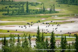
The slideshow ‘tells the story’ of Purnululu National Park and the Bungle Bungle Range starting with a series of aerial views of this remarkable landscape. Flying over the range in a helicopter or light aircraft is definitely one of the best ways to appreciate this place. Back on terra firma, the slideshow continues with a series of photos showing the typical beehive-shaped karst sandstone cones which are visible as you approach the hills, and some of the narrow gorges, caverns, seasonal pools and isolated stands of tall palms that are found in the interior. The composition of the sandstone beds is illustrated and the slideshow finishes with some wider views of the broader landscape of Purnululu National Park, showing the spinifex grasslands and tropical savannas that provide the setting for the isolated Bungle Bungle Range.
The following Flickr photographers are acknowledged with thanks for their contributions to this slideshow: Brian Yap, Robyn Jay, David Denicolo, Ian Cochrane, Stephan Ridgway, Rodney Campbell and Allessandro.
Factfile
Website Category: Earth Features
Area: 2,397 km2
Inscribed: 2003
Criteria:
- Outstanding natural beauty (vii);
- Geological features (viii);