EXPLORE Ningaloo Coast with this slideshow, check the location map and get all the facts and information below.

For slideshow description see right or scroll down (mobile). Click to view slideshow

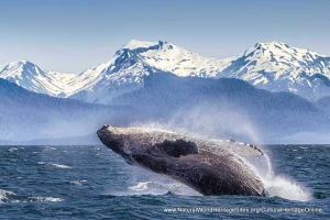
Location and Values: The Ningaloo Coast is located in the remote north-west of Australia and includes one of the longest near-shore coral reefs in the world. Its diverse marine life is particularly noteworthy for supporting the world’s largest known seasonal congregation of (300-500) whale sharks, and for the diversity and abundance of its marine turtles. An estimated 10,000 turtle nests are made along the coast annually and the area is subject to a seasonal upwelling of nutrients which results in spectacular mass coral spawning and a surge in marine productivity. The site includes some adjacent terrestrial areas, which feature a substantial network of flooded caves inhabited by a diversity of rare cave fauna.
Conservation Status and Prospects. According to IUCN’s Conservation Outlook Assessment (2020) the conservation status of the Ningaloo Coast is ‘good, with some concerns’. The IUCN report notes that the area benefits from a high degree of natural protection as a result of its remote location, while identifying climate change as the greatest threat to its long-term conservation. In the long term, climate change is likely to result in rises in seawater temperatures causing coral bleaching, as well as increasing sea levels, wave energy and ocean acidification. Although the Ningaloo Coast was not affected by the major recent coral bleaching events that affected the Great Barrier Reef, it was affected by a similar event in 2011, and these events are likely to happen with increasing frequency in future. Other threats to the marine environment, including those from coastal development, oil spills from shipping and offshore production platforms, recreational fishing and other visitor activities are generally well controlled. The terrestrial parts of the site are affected by livestock grazing by the indigenous Gnulli people and there are still a number of invasive species requiring ongoing control measures.
Links:
Google Earth
Official UNESCO Site Details
IUCN Conservation Outlook
UNEP-WCMC Site Description
Slideshow description

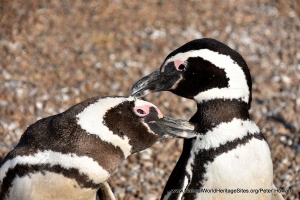
The slideshow ‘tells the story’ of the Ningaloo Coast with a portfolio of photos that illustrate the landscape features of this outstanding place, together with some of the typical marine life, plants and animals. It starts with some aerial views of the Muiron islands in the far north of the site, before showing some of the extensive white sand beaches and turtles hauling up onto the shore to nest. Some of the marine life along the Ningaloo Coast – breaching whales, whale sharks, turtles, corals, fish and a ray concealing itself in a sandy area of the sea floor is shown. The second part of the slideshow illustrates the shoreline features on the mainland, with its extensive sandy beaches at Shark Bay and Coral Bay, and the rocky inlets at Yardie Creek in the Cape Range National Park component of the site. Some of the typical birds and other animals are shown, including osprey, black-footed rock wallaby and turtles mating in the sea and beaches.
The following Flickr photographers are acknowledged with thanks for their contributions to this slideshow: Rainer von Brandis (IUCN), Michael Sale, Brain Yap, Julie Edgeley, Ian Cochrane, Thomas Jundt, Julie Burgher, Travolution360, Thomas McMurray, Graeme Churchard, SydneyDawg2006, Roderick Elme and Matt.
Factfile
Website Category: Marine & Coastal
Area: 6,045 – 7,050 km2
Inscribed: 2011
Criteria:
- Exceptional natural phenomenon (vii);
- Outstanding natural beauty (vii);
- Natural habitat for biodiversity (x);
- Significant number of rare, endemic and/or endangered species (x)