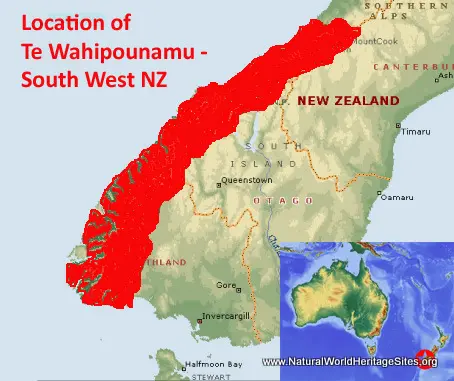
EXPLORE Te Wahipounamu – South West New Zealand with this slideshow, check the location map and get all the facts and information below.
For slideshow description see right or scroll down (mobile). Click to view slideshow
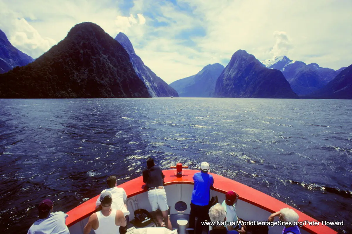
Location and Values: The Te Wahipounamu – South West New Zealand world heritage site covers an extensive complex of adjacent national parks and protected areas in the southwest corner of New Zealand’s South Island. It is a mountainous wilderness of outstanding scenic beauty, with snow-capped mountains, glaciers, fiords, forests, tussock grasslands, lakes, wild rivers, waterfalls and wetlands. Two-thirds of the park is covered in temperate rainforests, with ancient stands of southern beech and Podocarpus trees, representing the world’s best modern example of the ancient biota that once covered the supercontinent of Gondwana. These forests provide habitat for an extensive range of New Zealand’s unique endemic fauna, including the kea (an alpine parrot), takahe (a large flightless bird), and two species of kiwi (also flightless birds). The kakapo (the world’s rarest and heaviest parrot) survived in the area until the early 1980s, but is probably now restricted to small populations on isolated offshore islands.
Conservation Status and Prospects. According to IUCN’s Conservation Outlook Assessment (2017) the conservation status of Te Wahipounamu – South West New Zealand is ‘good, with some concerns’. The IUCN report notes that the greatest threat is from invasive alien animals browsing indigenous vegetation and predating on wildlife, particularly birds. Current programmes for monitoring and control of these pests are only being applied in localized parts of the site. Less significant threats exist in specific parts of the site from (1) the grazing of domestic livestock; (2) mining operations; (3) a growing demand for tourism facilities development, including new road corridors and increased aircraft access; and (4) the potential for water export. In the longer term, climate change is likely to impact vegetation distribution, and contribute to habitat fragmentation, alien species invasion, and the already marked reduction in the volume of permanent ice.
Links:
Google Earth
UNESCO Official Website
IUCN Conservation Outlook
UNEP-WCMC Site Description
Birdlife IBA
Slideshow description
The slideshow ‘tells the story’ of Te Wahipounamu – South West New Zealand, showing the landscapes and habitats, plants and animals, and illustrating some of the threats and conservation needs. Most of the photos were taken by Peter Howard during a visit in January 1999, with additional material by Nigel Dudley and Sue Stolton (Equilibrium Research). The slideshow starts with an over-flight of the glaciers and snowfields of the Mount Cook National Park, with its 19 rocky peaks over 3,000m. It then covers a walk to the base of the Franz Josef Glacier, and shows some of the exuberant vegetation in this lowland area of rain-drenched SW New Zealand. Here stands of giant tree ferns can be found together with a wealth of endemic birds such as the weka, and kereru (New Zealand Wood Pigeon). The slideshow continues to the far south-west with a visit to Milford Sound in the heart of fiordland, and its remarkable glacial scenery, gushing waterfalls and perpetual mists. In the Sound and along this coastline New Zealand fur seals haul themselves onto the rocks, while dolphins and whales patrol the waters offshore. The trees of the temperate rainforests are smothered in mosses and lichens, and visitors are likely to see some of the unusual endemic birds, such as kea (a big parrot) and blue duck, but will require more perseverance to catch a glimpse of the rarer birds (such as takahe, kiwi, kaka and kakariki) that inhabit the area.
Factfile
Website Categories: Temperate & Boreal Forests; Islands; Earth Features
Area: 26,000 km2
Inscribed: 1990
Criteria:
- Outstanding natural beauty (vii);
- Geological features (viii);
- Ecological processes (ix);
- Significant number of rare, endemic and/or endangered species (x)


