EXPLORE New Zealand’s Tongariro National Park with this slideshow, check the location map and get all the facts and information below.
For slideshow description see right or scroll down (mobile). Click to view slideshow

Location and Values: Tongariro National Park is located in the centre of New Zealand’s North Island and features a string of active volcanoes along the ‘Pacific Ring of Fire’. It is a scenically spectacular area with classic recent volcanic cones, craters and crater lakes, explosion pits, lava flows and hot springs. The summit of the highest peak, Mount Ruapehu is ice-bound and snow covered for much of the year, and the central area of the park carries evidence of past glaciers which carved valleys and deposited moraines during the last ice age. It is the world’s most frequently active composite volcano complex. Its close integration into the culture of the Ngati Tuwharetoa (Maori) peoples and their belief systems is also recognized in the listing of Tongariro National Park as a mixed site, satisfying world heritage cultural criteria, as well as natural ones.
Conservation Status and Prospects. According to IUCN’s Conservation Outlook Assessment (2017) the conservation status of the Tongariro National Park is ‘good’. The IUCN report notes that ‘The conservation outlook for the site is good. The outstanding universal value of this property benefits from strong and effective legal, institutional and management regimes. Management is guided by a comprehensive management plan, is resourced in terms of finance and staffing, and has the support of key stakeholders. There is close collaboration with local indigenous communities but increasing concern is being expressed by them and interest groups that the management plan and its policies do not adequately protect their assessment of environmental and cultural values. Threats to the property from both internal and external sources are well recognized and understood, and most are subject to active, appropriate and effective management intervention which is, however, requiring increasing resources to continue to be effective. ’
Links:
Google Earth
Official UNESCO Site Details
IUCN Conservation Outlook
UNEP-WCMC Site Description
Slideshow description

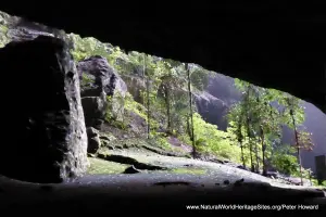
The slideshow ‘tells the story’ of New Zealand’s Tongariro National Park with a portfolio of photos by Peter Howard from a visit in January 2018. It starts at the excellent park visitor centre in Whakapapa village, where there are a number of exhibits to explain the important values of the site, as well as the threats and management challenges and Maori traditional beliefs and association with the area. The next photos in the series shows the rainforest around Lake Rotopounamu, an outlying area to the north of the main volcano complex where special efforts are being made to protect and restore the unique ecosystem by exterminating introduced pests – such as stoats, rats and possums – and allow the native fauna to recover, through re-introductions where necessary. Here, amongst the lush vegetation of tree ferns and moss-draped rainforest trees around the lake shore, visitors can see some of the unique fauna, including the endemic North Island Robin and Kaka (parrot). The next few photos show the beautiful Tawhai Falls, set in a small gorge of southern beech (Nothofagus) forest.
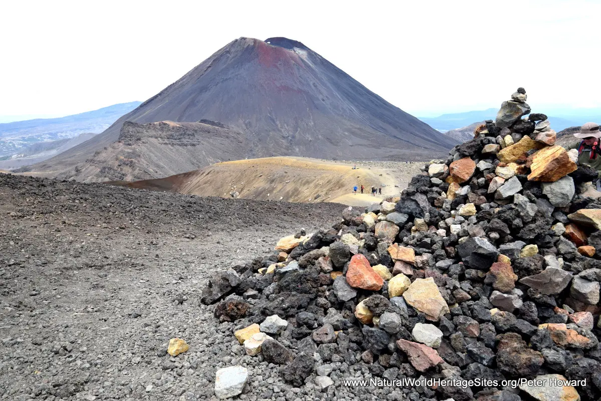
The most popular trek at Tongariro National Park is the renowned Tongariro Alpine Crossing, a full-day hike through some of New Zealand’s most spectacular scenery. Some of the highlights of this spectacular trek are shown, starting at the Mangatepopo road head and following the boardwalk through the alpine meadows and past a soda spring to climb over the scree slopes into the South Crater with the perfect cone of Mount Ngauruhoe as a backdrop. The path ascends to 1,886m on the rim of the stunning Red Crater, before descending across a loose volcanic scree slope to the beautiful Emerald Lakes with their steaming vents and far-reaching views. Further on the trek passes the Blue Lake and windes its way past the sacred Ngati Tuwharetoa site at Ketetahi hot springs (access prohibited) in a zig-zag of paths descending steeply to the road-head more than 1,000m below at Ketetahi.
The next part of the slideshow illustrates the high alpine area of Mount Ruapehu, the park’s highest peak (2,797m), and one of New Zealand’s most popular ski fields. Two chair lifts take visitors to an elevation of 2020m, from where trekkers can climb onto the Skyline Ridge through glaciated valleys for spectacular views – if the weather is good enough! The last part of the slideshow features the half-day trek to the Taranaki Falls and Tama Lakes.
Factfile
Website Categories: Mountains; Earth Features
Area: 796 km2
Inscribed: 1990 (Extension 1993)
Criteria:
- Exceptional natural phenomenon (vii);
- Outstanding natural beauty (vii);
- Geological features (viii);
- Cultural criterion (vi)