EXPLORE Wadden Sea with this slideshow, check the location map and get all the facts and information below.
For slideshow description see right or scroll down (mobile). Click to view slideshow

Location and Values: The Wadden Sea is the world’s largest continuous area of intertidal sand and mud flats, extending for 650 km along the coasts of the Netherlands, Germany and Denmark. There are seven component parts within the world heritage site, all of which are managed as state-owned conservation areas and national parks. The coastal wetland environment includes a diversity of habitats with mudflats, salt marshes, tidal channels, sea-grass meadows, estuaries, beaches, dunes and sandbars. It serves as one of the world’s most important areas for migratory birds, with up to 6.1 million birds present at the same time and as many as 10-12 million passing through the area each year. The Wadden Sea provides critically-important habitat along the East Atlantic Flyway, and contributes to the conservation of African-Eurasian migratory waterbirds (together with other sites such as world-heritage listed Banc d’Arguin, Djoudj, Donana and Ichkeul National Parks). It is a highly productive ecosystem which not only supports vast numbers of birds, but equally impressive populations of invertebrates, fish, shellfish and marine mammals such as harbor seals, grey seals and harbor porpoises.
Conservation Status and Prospects. According to IUCN’s Conservation Outlook Assessment (2020) the conservation status of the Wadden Sea is ‘good’. The IUCN report recognises that the site inherited a legacy of ecological damage (for example, seals were hunted in the area until the 1970s), and there are still a large number of current and potential threats. However, ecological restoration has been largely effective and good monitoring and management regimes are now being implemented throughout the site.
Some significant threats remain in areas beyond the site boundaries. Population monitoring of migratory and breeding waterbirds indicates that a majority of species are in decline. The underlying causes for fluctuations in bird populations remain poorly understood and may originate elsewhere, so remedial action to address observed declines in the populations of particular species is difficult. The greatest long-term threat to conservation of the site’s values is sea level rise associated with climate change (and the melting of the polar ice caps), as this could be catastrophic for the intertidal zones and populations of wading birds that use them.
Links:
Google Earth
Official UNESCO Site Details
IUCN Conservation Outlook
UNEP-WCMC Site Description
Birdlife IBA
Slideshow description

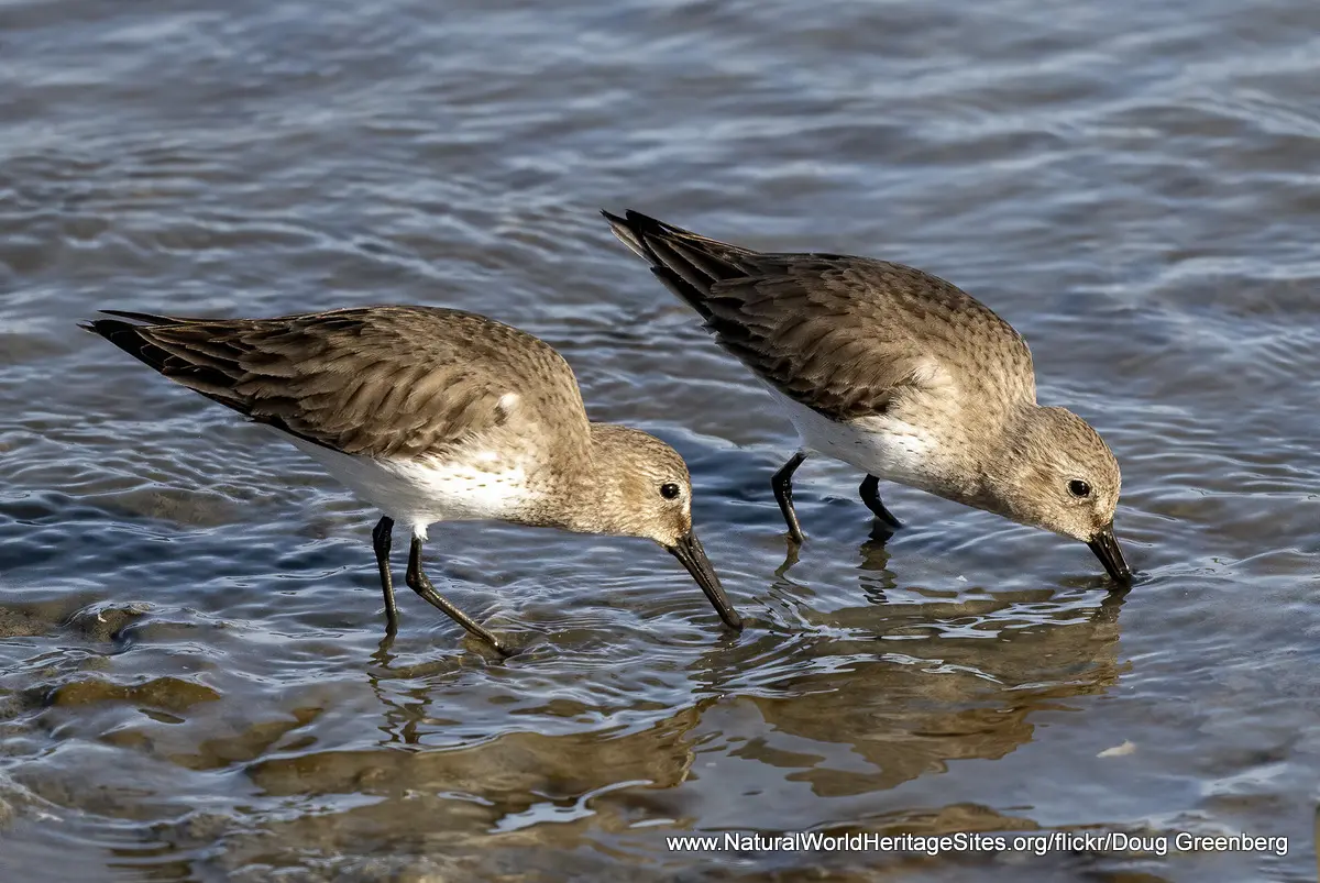
The slideshow ‘tells the story’ of the Wadden Sea with a portfolio of photos that illustrate the landscape features and principal types of habitat within the site, as well as some of the more prominent birds and mammals. The entire West-European population of dunlin uses the Wadden Sea and this species features prominently in the slideshow with densely-packed groups of birds feeding on the mudflats, portraits of individual birds, and vast flocks flying overhead. The area is used by large numbers of shelduck during the moulting season, as well as overwintering eider. Most of the world population of the dark-bellied brent goose use the Wadden Sea and feed on the adjacent meadows, while harbor seals are commonly seen in the waters offshore, and basking on sandbanks.
The following Flickr photographers and other sources are acknowledged with thanks for their contributions to this slideshow: Tony Morris, Alberto_VO5, Doug Greenberg, Henry T. McLin, Jim Culp, Nigel, Sergey Yeliseev, shell game, Tony Varela Photography, Claude Daupagne, Finn Jensen, Hans Norelius, Huhnerauge, Jens Hansen, Lloyd K. Barnes, Matthias Serfling, Michael Bertulat, Mike Bing, Paul Downey, Rob Oo, Silverleapers, Thomas Gerhard, Varde Kommune, steeedm, abbilder, Khun Hans, Linda Alexandersson and Stuart Borrett.
Factfile
Website Categories:
Marine & Coastal
Earth Features
Area: 11,434 km2
Inscribed: 2009 (extended 2014)
UNESCO Criteria:
- Geological features (viii);
- Ecological processes (ix);
- Natural habitat for biodiversity (x);