EXPLORE Australia’s Wet Tropics of Queensland with this slideshow, check the location map and get all the facts and information below.
For slideshow description see right or scroll down (mobile). Click to view slideshow

Location and Values: Australia’s Wet Tropics of Queensland is a serial site with 13 separate component areas spread along the northeast Queensland coast between Cooktown and Townsville. The area includes a diversity of plant communities and animal habitats, but is primarily wet tropical rainforest, with some tall open forests and woodlands on its drier western margins and some wetlands, swamps and mangrove forests along the coast. It is exceptionally rich in biodiversity and many of its species are found nowhere else on earth. Although the Wet Tropics of Queensland covers less than 0.2% of Australia’s land surface, some 18% of the continent’s vascular plants (over 3,000 species) are found at the site, together with 40% of its birds (368 species) and 30% of Australia’s marsupial mammals. It is listed under all four world heritage natural criteria, recognising its exceptional scenic qualities (which include far-reaching views of mountains cloaked in pristine rainforest, wild rivers, waterfalls and undisturbed coastal scenery adjoining the Great Barrier Reef world heritage site), as well as its importance as a living record of the evolution of land plants from the time when Australia broke away from the ancient supercontinent of Gondwana.
Conservation Status and Prospects. According to IUCN’s Conservation Outlook Assessment (2017) the conservation status of the Wet Tropics of Queensland is of ‘significant concern’. The IUCN report notes that ‘The Wet Tropics of Queensland World Heritage site is protected by a strong and updated legislative framework, a dedicated independent Management Authority which enjoys broad community support, and a comprehensive suite of management strategies. However, the insidious and damaging threat posed by invasive plants, animals and diseases, and the high risk posed by the predicted impacts of climate change present real danger to the continuing integrity of the site’s biodiversity and associated endemic species. Whilst significant efforts have been taken to address these threats on the ground, the level of investment does not appear to be commensurate with the urgency for significant preventative and remedial action, and likely consequences, of an ineffective response.’
Links:
Google Earth
Official UNESCO Site Details
IUCN Conservation Outlook
UNEP-WCMC Site Description
Birdlife IBA
Slideshow description

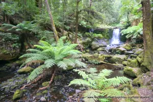
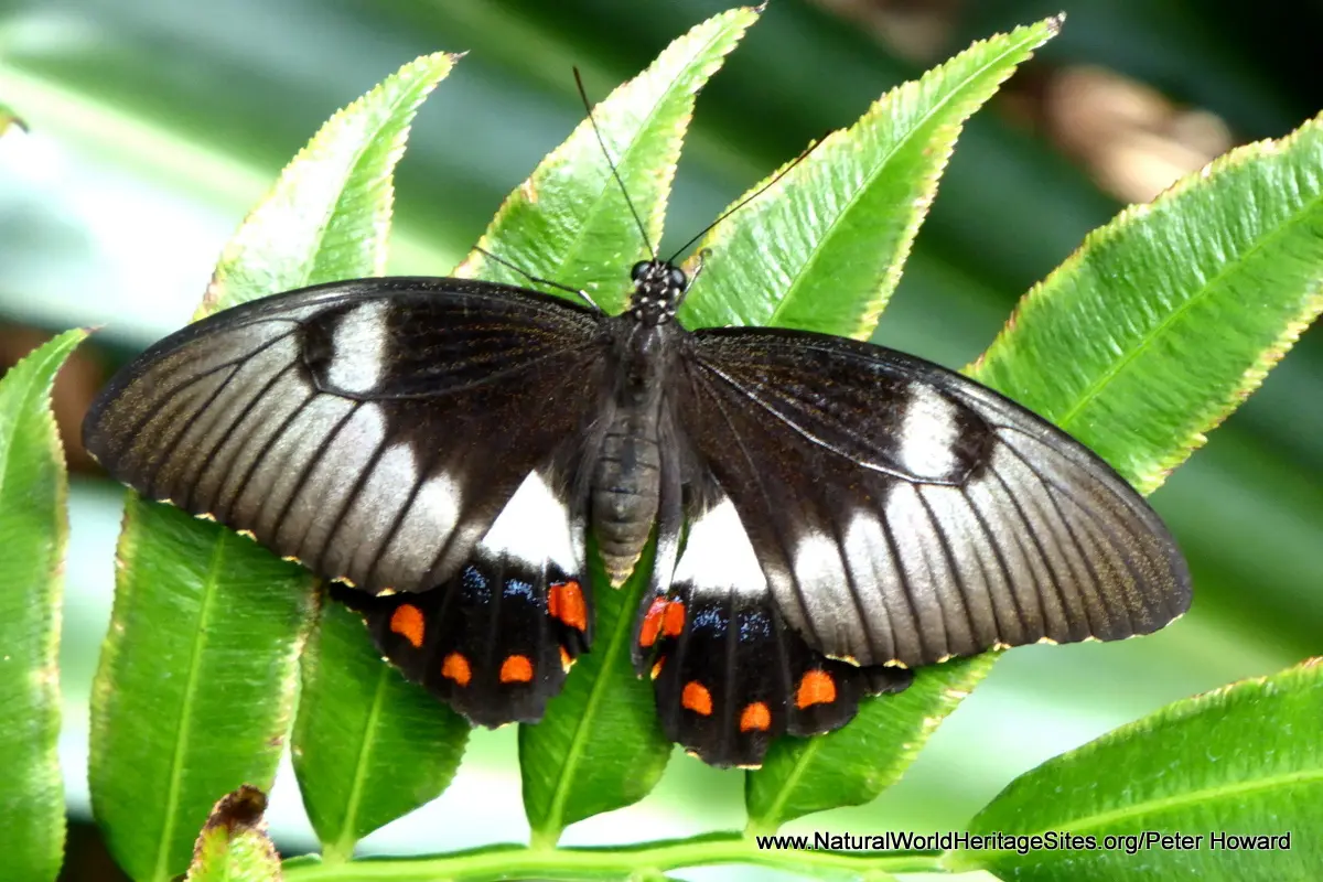
The slideshow ‘tells the story’ of Australia’s Wet Tropics of Queensland with a portfolio of photos by Peter Howard from a visit to the southern portion of the world heritage site in January 2018. The journey starts with some coastal views over the mangrove swamps at Hitchinbrook channel, and aerial views of points where the rainforests meets the sea further north. It then takes a look at the rainforest interior, from the vantage point of the Mamu Tropical Skywalk, illustrating some of the typical animals and plants. The skywalk passes through the rainforest tree canopy and affords spectacular views across the forest-clad mountains of Australia’s Great Dividing Range in this part of the site, the Tully Gorge and Wooroonooran National Parks. From the elevated skywalk visitors may encounter some of the wildlife illustrated here – species of fern that tell of Australia’s origins as part of the Gondwana supercontinent; birds such as the Wompoo fruit dove, parrots, noisy pitta and southern cassowary (the world’s second heaviest bird); fruit bats, snakes, treefrogs and an assortment of colourful butterflies including the endemic Australian birdwing (Ornithoptera euphorion). The slides continue with views of the Crater Lakes National Park (Lakes Eacham and Barrine) and the surrounding rainforests, featuring more of the Wet Tropics plants and animals – including the two giant Atherton Kauri pines at Lake Barrine (Agathis microstachya) a rare endemic tree of the ancient Araucariaceae family) and a splendid rainforest lizard, the Boyd’s Forest Dragon. The slideshow continues at The Babinda Boulders in Wooroonooran National Park, with photos of the rushing torrents and sculpted rocks as well as aquatic creatures such as long-necked turtles, Australian rainbow fish and estuarine crocodiles. The last few photos feature a section of the main Bruce Highway (A1 coastal road) where special measures have been introduced to mitigate the potential impacts of traffic road-kill by providing wildlife underpasses and rope bridges for arboreal species like possums to cross the road.
Factfile
Website Category: Tropical & Sub-tropical Forests
Area: 8,934 km2
Inscribed: 1988
Criteria:
- Outstanding natural beauty (vii);
- Ecological processes (ix);
- Natural habitat for biodiversity (x);
- Significant number of rare, endemic and/or endangered species (x)